B. People and Environments · Global CommunitiesGlobes and World Maps
B3.1 B3.3 B2About 35 minutes
Learning goals- I can explain how a globe and a world map are the same and different.
- I can tell land from water on a globe or world map.
- I can find the title, legend and compass rose on a map.
- I can find Canada on a globe and on a world map.
Words to know
Earth
The planet we live on. It is shaped like a ball.
globe
A round model of Earth. It shows land and water in their real shapes.
world map
A flat drawing of the whole Earth, so you can see every place at once.
legend
The box on a map that tells what each symbol and colour means. It is also called a key.
compass rose
A symbol on a map that shows the directions north, south, east and west.
country
A land with its own borders and its own government, like Canada or Mexico.
From your street to the whole world
In Grade 1 you made maps of your room and your community. You learned that a map shows a place from above, and that a legend tells what the symbols mean.
Now we are going to zoom out. Way out! Imagine you are in a rocket, flying higher and higher. Your house gets tiny. Your town gets tiny. Soon you can see the whole Earth, round like a ball, with blue oceans and big pieces of land.
In this unit you will learn about communities all around the world. To find them, we need two tools: a globe and a world map.
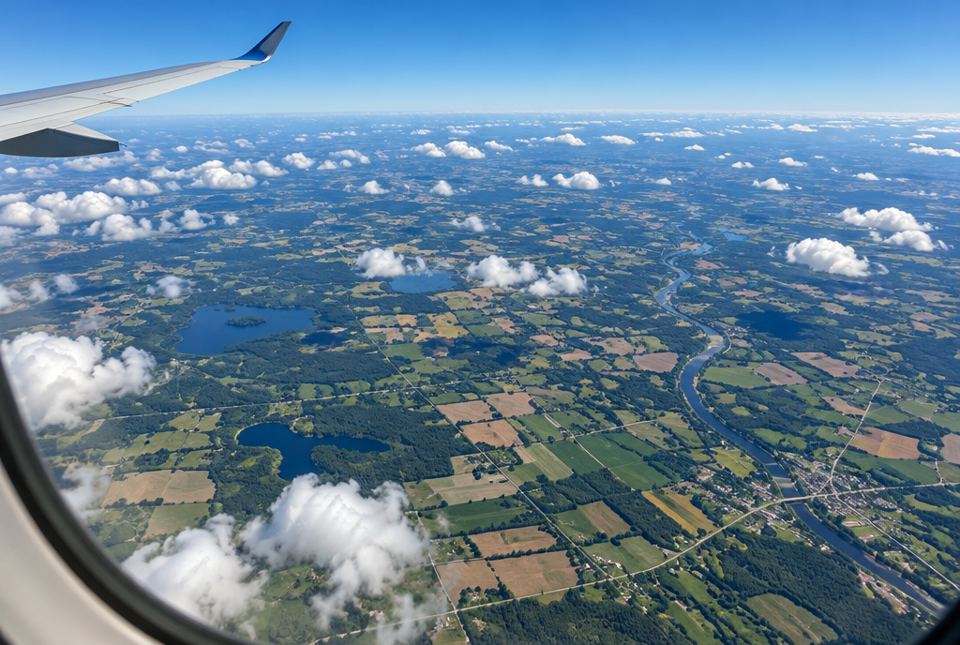 From high up, houses and roads look tiny and you see land and water from above, just like on a map. Imagine going even higher, until you see the whole round Earth! AI-generated imageA globe is round like Earth. A world map is flat, so you can see all of Earth at the same time.
A globe
A globe is a model of Earth. It is round, just like Earth. It sits on a stand, and you can spin it to see different sides.
A globe shows the shapes and sizes of land and water the right way. But you can only see half of it at a time. And it is hard to carry in your backpack!
A world map
A world map is a flat picture of Earth. You can see every place at once. You can fold it, put it in a book (a book of maps is called an atlas), or look at it on a tablet or computer.
But Earth is round, so a flat map has to stretch some places to make them fit. On many world maps, places near the top and bottom look bigger than they really are.
| Globe | World map |
|---|
| Shape | round, like a ball | flat |
| What you can see | about half of Earth at a time | the whole Earth at once |
| Sizes and shapes | correct | some places are stretched |
| Easy to carry? | no | yes (folded, in a book, or on a screen) |
| The same | both show land, water, continents, oceans and countries | both show land, water, continents, oceans and countries |
Land and water
Look at any globe or world map. You will see a lot of blue. Blue means water. Most of Earth is covered by water, mostly by the big salty oceans.
The other colours show land. Mapmakers often colour each country a different colour so you can see where one country ends and the next one begins. The line between two countries is called a border.
Parts of a map
Most good maps have these parts:
- a title that tells what the map shows (like Map of the World)
- a legend (or key) that tells what the symbols and colours mean
- a compass rose that shows north, south, east and west
Always read the title and the legend first!
Worked exampleLet's find Canada
Where is Canada on the world map?
- Look for the large piece of land at the top left of the map. Its name is North America.
- Canada is the top part of North America. It is very big. Canada is the second-largest country in the world. Only Russia is bigger.
- Look at the water around Canada. There is an ocean to the west (the Pacific Ocean), an ocean to the east (the Atlantic Ocean) and an ocean to the north (the Arctic Ocean).
- Look south of Canada. Our neighbour there is the United States.
Canada is in the top part of North America, with oceans on three sides (west, east and north) and the United States to the south.
Worked exampleGlobe or map?
Which tool would be best for each job?
- You want to see all the countries of the world at the same time.
- You want to see the real shape of Earth.
- You want to take a map of the world on a trip.
- Job 1: A globe only shows half of Earth at a time. A world map shows everything at once.
- Job 2: Earth is round. The globe is round too, so it shows the real shape.
- Job 3: A globe is big and round. A world map can be folded or kept on a tablet.
- world map 2. globe 3. world map
Riddle timeWhat has cities but no houses, rivers but no water, and forests but no trees?
A map!
Hands-on activityThe orange peel puzzle
You need: an orange (or a clementine), a marker, and a grown-up to help.
- Pretend the orange is Earth. Draw a few blobs of 'land' on it with the marker.
- Peel the orange carefully in big pieces.
- Now try to lay the peel flat on the table so it makes a neat rectangle, with no gaps and no tearing.
- It is impossible! You have to tear, stretch or squish it.
Talk about it: This is the mapmaker's problem. To make a flat world map from a round Earth, some places have to be stretched. That is why a globe shows the real shapes best.
Bonus: If you have a globe or a world map at home (or on a tablet), find Canada, then find the ocean that is closest to where you live.
Your turn
1Is a globe round or flat?
2Is a world map round or flat?
3What colour usually shows water on a globe or map?
4Is most of Earth covered by land or by water?
Water. There is much more water than land.
5What part of a map tells you what the symbols and colours mean?
The legend (also called the key).
6What does a compass rose show?
The directions: north, south, east and west.
7Canada has oceans on three sides. Name one of them.
Any one of: the Pacific Ocean (west), the Atlantic Ocean (east) or the Arctic Ocean (north).
More practice: warm-up
1What is the name for a book of maps?
2Which shows the whole world at once: a globe or a world map?
3What do we call the line between two countries?
4Which country is Canada's neighbour to the south?
5What should you read first on a map?
The title (to know what the map shows) and the legend (to know what the symbols mean).
More practice: on your own
1Tell one way a globe and a world map are the same.
Both show land and water (continents, oceans and countries). Both are models or pictures of Earth.
2Tell one way a globe and a world map are different.
A globe is round and a map is flat. Or: a map shows the whole world at once, but a globe shows only half at a time. Or: a globe shows real shapes, but a map stretches some places.
3Why do some places on a world map look bigger than they really are?
Earth is round. To make it flat, the mapmaker has to stretch some places, especially near the top and bottom of the map.
4Your class wants to see the real shape of Earth. Should they use a globe or a world map? Why?
A globe, because it is round like Earth, so the shapes and sizes are correct.
5Name three parts most maps have.
A title, a legend (key) and a compass rose.
Challenge
1Leo says, "On my world map, Greenland looks almost as big as Africa, so they must be the same size." Is he right? How could he check?
No. Greenland is near the top of the map, so it gets stretched. Africa is really much bigger. Leo could check on a globe, which shows real sizes.
2You are planning a car trip from Toronto to Ottawa. Would a globe or a road map help you more? Explain.
A road map (a flat map, on paper or on a phone). It shows roads and towns up close. A globe is too small to show roads, and you cannot take it in the car easily.
3Why do you think most of a globe is blue?
Because most of Earth is covered by water, mostly oceans. Blue shows water.
Quiz
1. Which is a round model of Earth?
2. Which can show the whole world at once?
3. On most maps and globes, blue shows...
4. What does a legend tell you?
5. Canada is in which part of the world?
6. Which ocean is west of Canada?
Big idea: A globe is a round model of Earth that shows true shapes and sizes. A world map is flat, shows everything at once, but stretches some places. Both show land, water, continents, oceans and countries.
How to help at home:
- If you have a globe, an atlas or a world map (paper or online), let your child explore it freely. Ask "What do you notice?" before explaining.
- Point out maps in daily life: weather maps on TV, map apps, transit maps. Ask, "Where is the title? Is there a legend?"
- Find Canada, your province (Ontario) and the closest Great Lake or ocean together.
Common difficulties:
- Thinking the world map shows true sizes. Compare Greenland and Africa on a globe and on a map. The orange-peel activity makes the stretching idea concrete.
- Confusing countries and continents. That comes in the next lesson. For now, a country has its own borders and government (Canada), and it sits on a big piece of land called a continent (North America).
- Mixing up the parts of a map. Use the same three words each time: title, legend, compass rose.